This article describes how Viametris mobile scan data should be formatted to be imported into Cintoo and outlines the workflow to do so.
Permissions: users with roles including Upload or Delete Reality Data permission can import Viametris format scans with Cintoo Connect.
More about Viametris devices here: Viametris.

Data expected by Cintoo Connect from Viametris Mobile Indoor devices is the following:
- Unstructured point cloud in E57 format
- Walking /scanning path in XYZ format
Copy/paste the XYZ file in the images folder
Viametris software will export scanning path in a file named xxx_Camera.xyz in a folder called SensorTrajectories. Manually copy this file and paste it in a corresponding images folder, so that it is located in the same folder as the corresponding panoramic images.
Importing Viametris data using Cintoo Connect
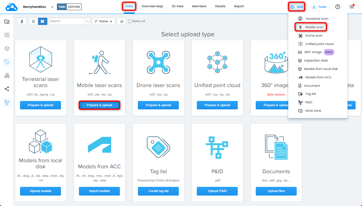
1. Open Data tab and click Prepare & upload on Mobile laser scans tile or click Mobile scan from Add drop-down menu on the top right. Cintoo Connect will launch.
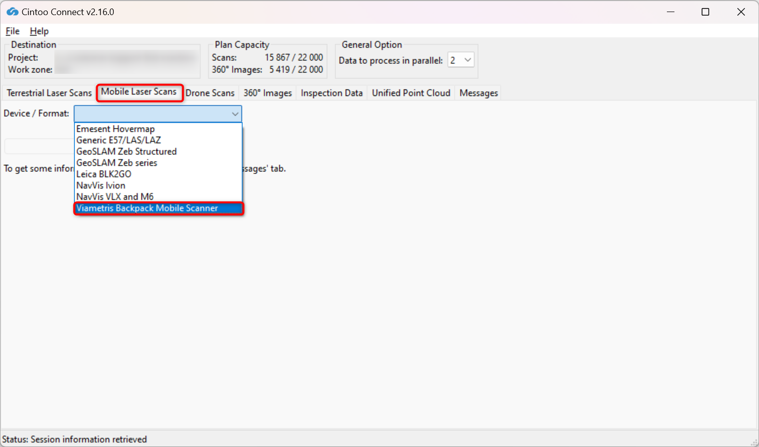
2. In Mobile Laser Scans tab select Viametris Backpack Mobile Scanner.
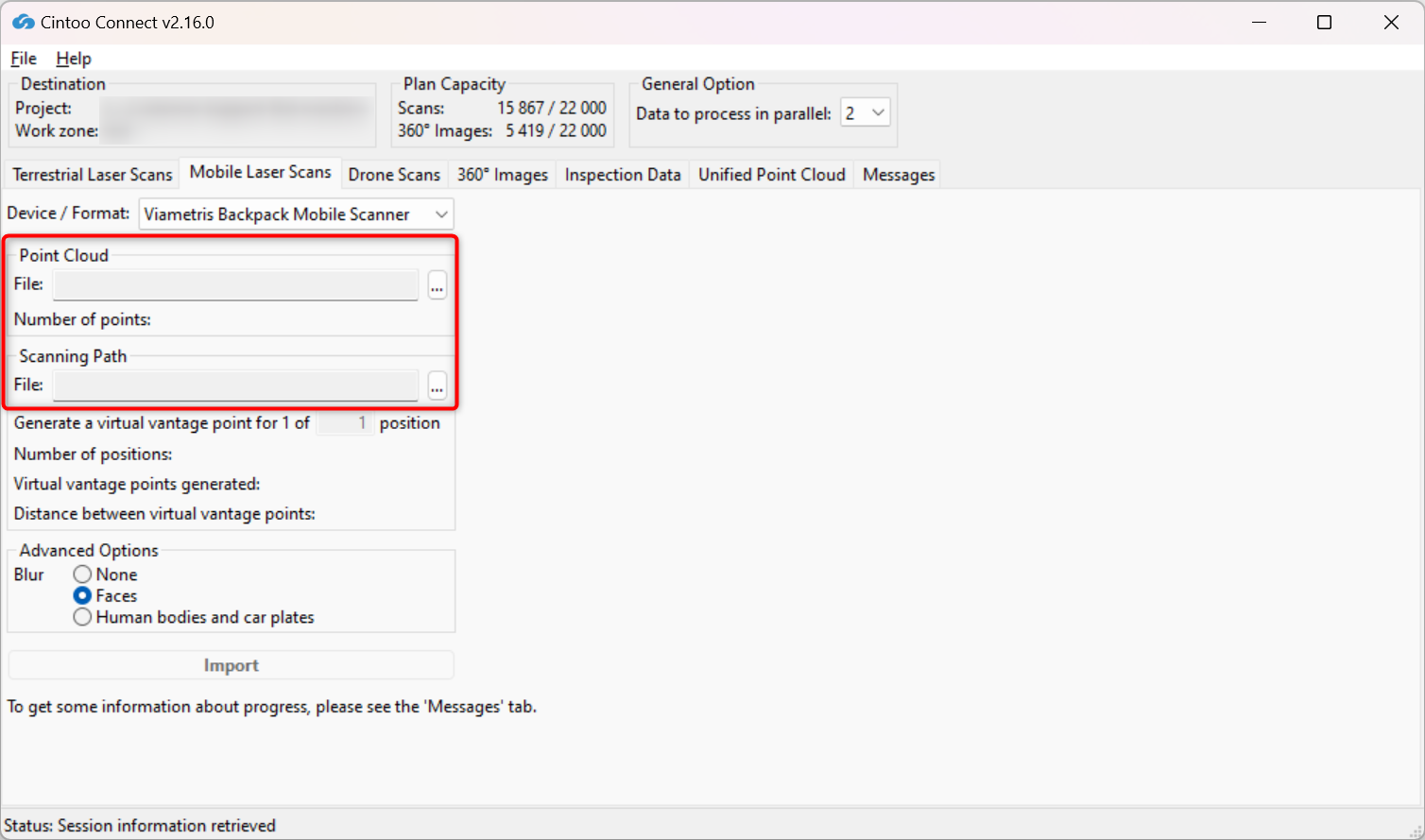
3. Select E57 as Point cloud and CSV file as Scanning path.
4. Modify Positions sampling value as needed:
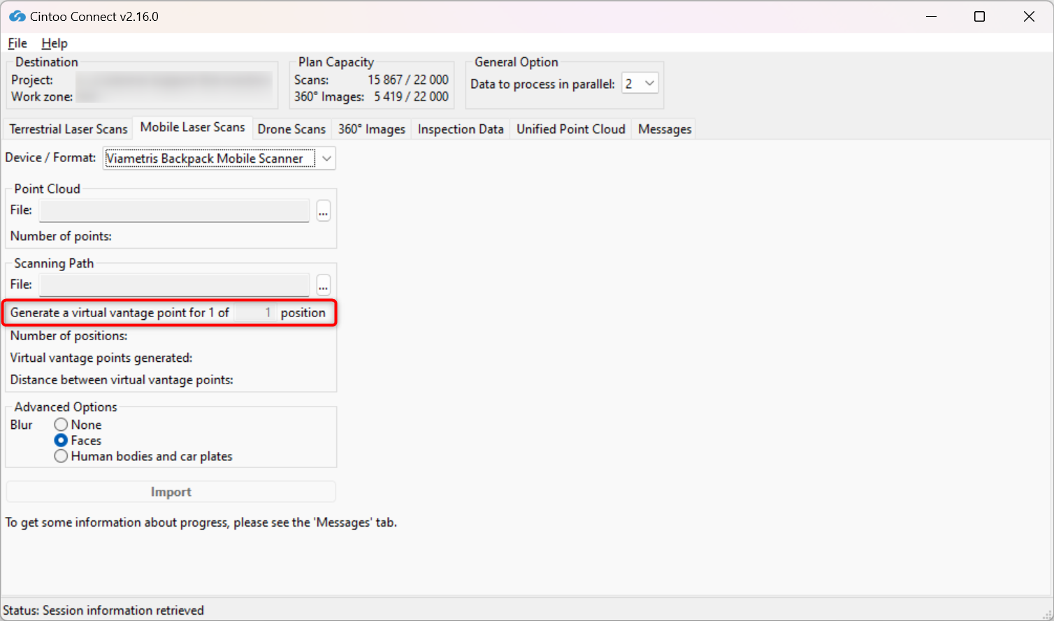
- For example, 4 will create 1 scan location for every 4 panoramic images included in scanning path.
- Number of 3D scans and average distance between each one will be indicated in Cintoo Connect and will be added to scan count.
5. Enable or disable Blur - Faces:
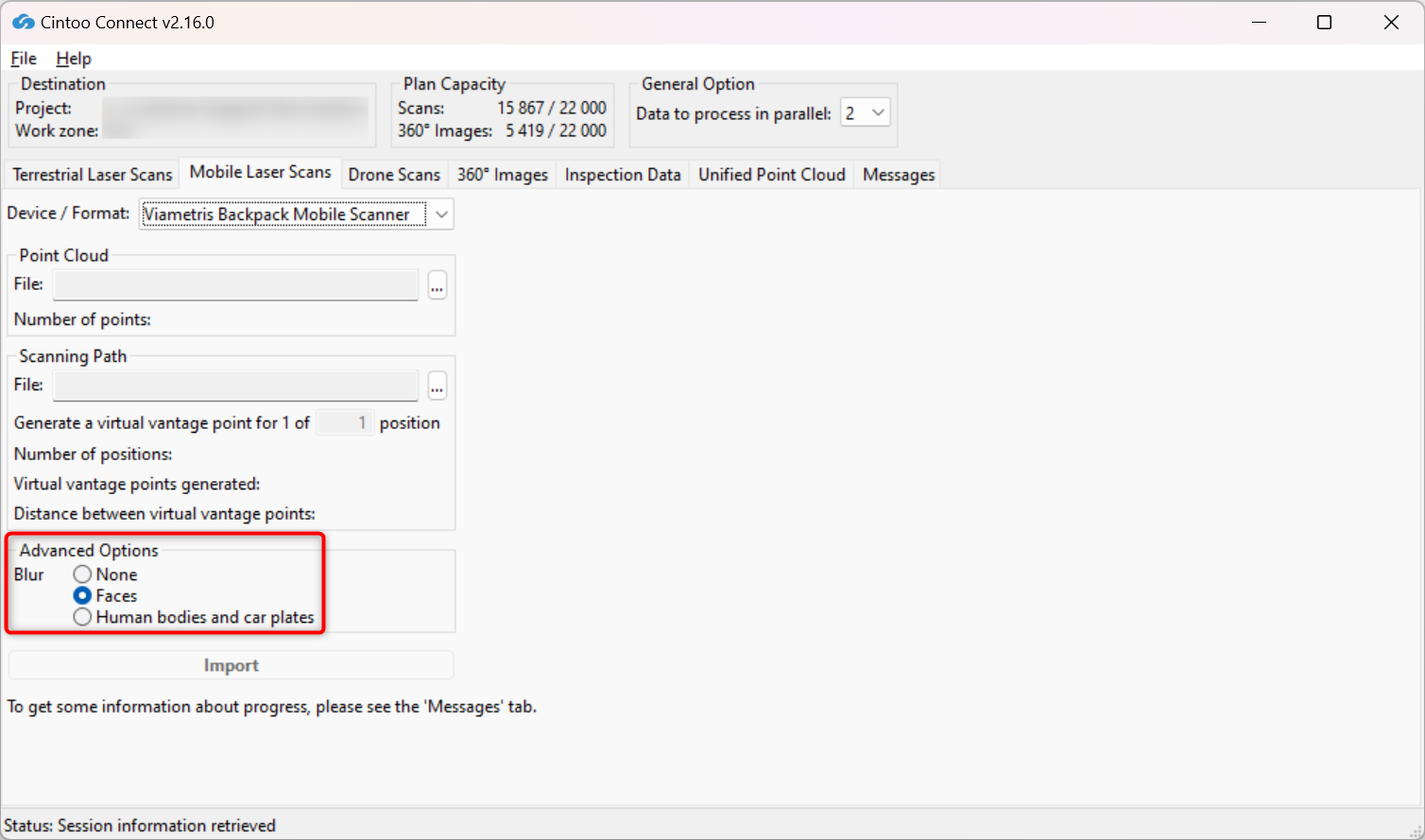
- This option is enabled by default, choose option None to not apply any blurring.
- This option automatically blurs faces captured in any panoramic images included in the scans being uploaded to Cintoo.
- Blurring cannot be undone in Cintoo after scans have been uploaded.
- Any files uploaded without Blur Faces option enabled must be deleted from Cintoo project and re-uploaded with the option checked to apply automatic face blurring.
6. Enable or disable Blur - Human bodies and car plates:
- This option is disabled by default, option Faces is chosen.
- Enable this option to automatically blur human bodies including faces and car plates captured on any panoramic images included in the scans being uploaded to Cintoo.
- Blurring cannot be undone in Cintoo after scans have been uploaded.
- Any files uploaded without Blur Human bodies and car plates option enabled must be deleted from Cintoo project and re-uploaded with the option checked to apply automatic blurring.
Warning: use carefully only if it is imperative, as scan import time might be doubled with the option enabled.
7. Click Import.
- Check Messages tab from time to time to see if the process is running smoothly
- New 3D scans will appear one by one in Cintoo project
Was this article helpful?
That’s Great!
Thank you for your feedback
Sorry! We couldn't be helpful
Thank you for your feedback
Feedback sent
We appreciate your effort and will try to fix the article